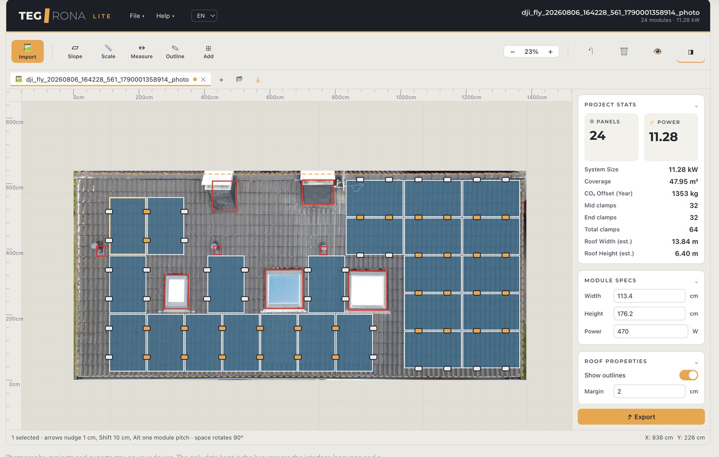
German company Tegrona has introduced Tegrona Lite, free software for planning the layout of photovoltaic systems directly on a photograph of a roof. The tool is aimed at installers and project planners who need to estimate during an initial site visit how many modules can be installed on a roof without using CAD tools or taking on-site measurements.
The software accepts drone photographs, images taken from the ground, and roof plans. Using the image, the user outlines the roof surface with three or four points and defines exclusion zones for obstacles such as chimneys, dormers, skylights and ventilation ducts.
One of Tegrona Lite’s technical features is perspective correction for photographs taken from the ground. In such images, eaves and ridgelines may appear distorted, while rows of roof tiles converge toward vanishing points.
The software uses the tiles themselves as a geometric reference. Because rows and columns of tiles are parallel on the roof, their lines can be used to identify vanishing points and calculate the transformation required to rectify the image.
The procedure also allows users to work with trapezoidal or triangular roof surfaces, for which a correction based solely on four corners would not accurately reproduce the surface geometry. Once the image has been rectified, the eave appears horizontal and the module rows can be aligned with it.
Tegrona Lite uses the known dimensions of the roofing material to convert the image into a scaled representation. The user selects the type of roof tile, and the software identifies and counts the tiles visible in the image to calculate the relationship between pixels and actual dimensions.
Source link