

For months, climate and weather experts have been warning about a historically strong Super El Niño that could turbocharge extreme weather across the world, intensifying everything from storms to floods to droughts.
Now AccuWeather has released its long-range Winter 2026-27 forecast, shedding more light on how that El Niño could affect this winter season across the U.S., and what specific conditions it may fuel.
“The stronger we see an El Niño signal, which is one of our top drivers when we look at seasonal forecasts, the more confidence we feel that certain things are going to take place,” says Paul Pastelok, AccuWeather senior meteorologist and long-range forecaster.
Meteorological winter doesn’t begin until December 1, so there’s still time for weather conditions to change, Pastelok adds.
But he and his team have spent about a month working on this forecast, looking at the trends of past years and previous El Niños, and relying on more than 100 climate models.
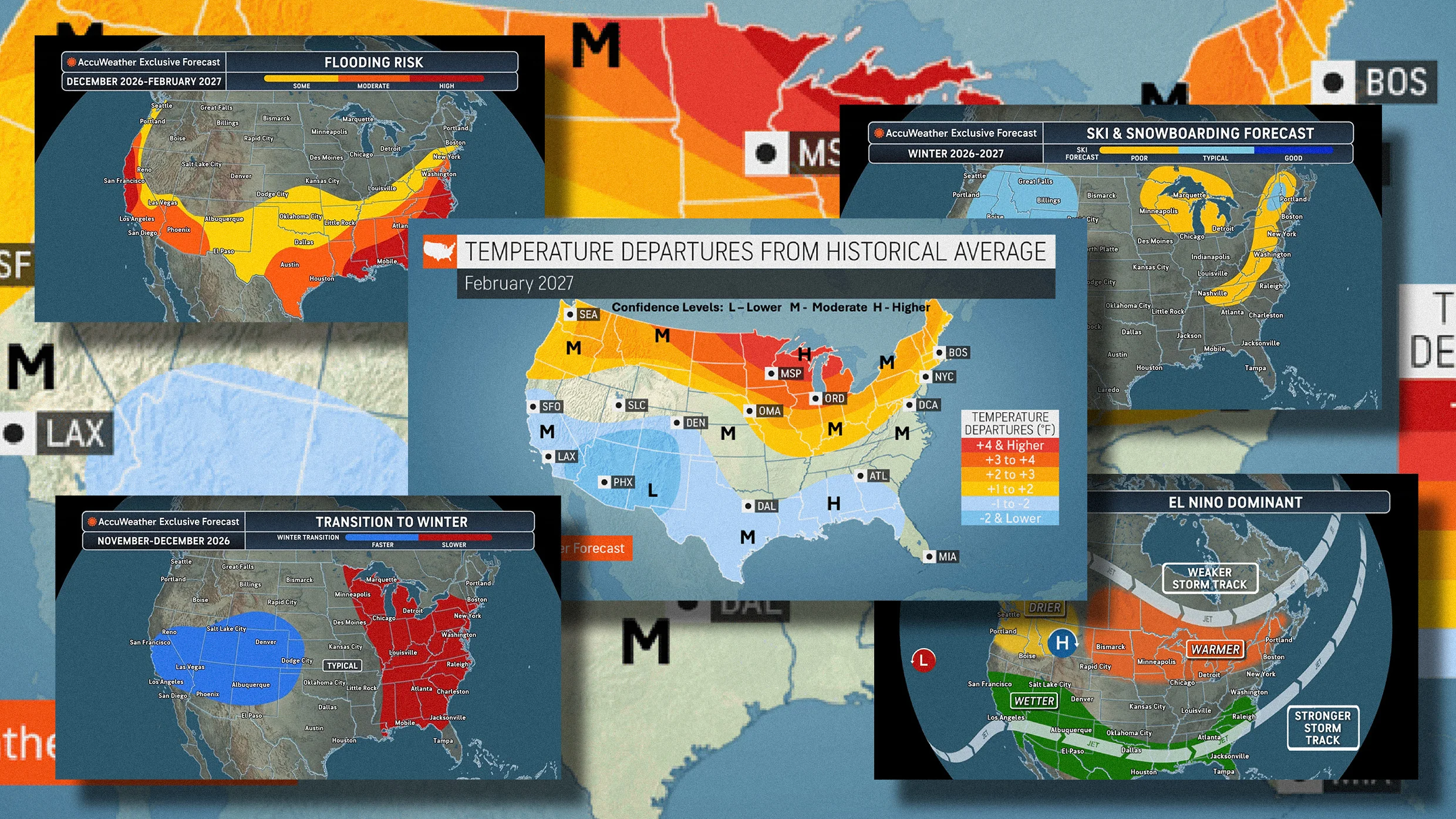
Here are five maps that illustrate the winter forecast, and El Niño’s potential impact.
El Niño is a climate phenomenon defined by above-average sea surface temperatures in the Pacific Ocean, and a weakening of trade winds that flow from east to west. All those changes affect atmospheric conditions, disrupting global weather patterns.
For the U.S., this typically leads to wetter conditions across the south and drier-than-normal conditions farther north.
This map illustrates those typical conditions, showing a “wetter” band across the southern half of the country, from San Francisco on the West Coast to Raleigh, North Carolina, on the East Coast; a “drier” spot in the Pacific Northwest; and a “warmer” region around the Great Lakes and into the Northeast.
Source link