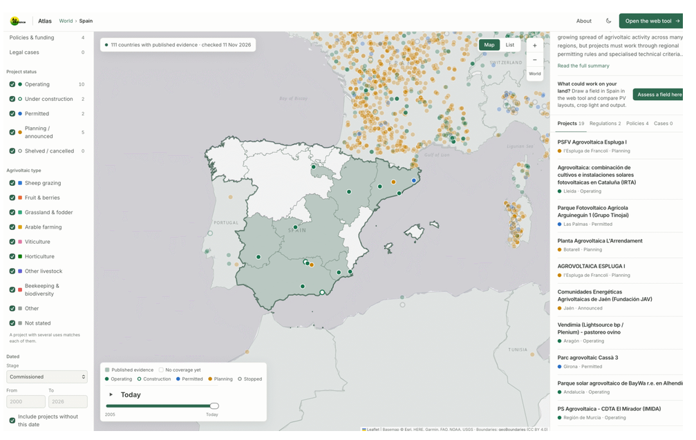
German consultancy AgRadiance has launched the AgRadiance Atlas, an open-access interactive platform that maps agrivoltaic projects worldwide and provides information on relevant regulations, support policies, and court rulings.
The atlas currently includes 2,697 projects across 109 countries, up from 37 projects identified worldwide in 2018. It provides geographical data for each project and allows users to examine regulatory conditions in individual countries and regions.
Each project is linked to its original publicly available source. The database also includes 151 projects classified as postponed or canceled.
The atlas tracks 523 regulations, policies, and court rulings relevant to the projects it covers. Users can select a country or region to view identified projects, the applicable regulatory framework, and a summary of local market conditions.
Users can filter projects by development status, agricultural activity – including fruit and berry cultivation, viticulture, horticulture, biodiversity conservation, and beekeeping – power capacity, and dates associated with different development stages. Records date back to 2009, allowing users to track project development over time.
In Spain, the atlas lists 10 operational projects, two under construction, two permitted projects, and five announced projects. It also includes two decrees governing agrivoltaic projects, along with four official orders and local strategic plans.
In Germany, the atlas identifies 229 projects and 74 regulations, policies, and procedures. It also provides a summary of the national market. Information for each territory is accompanied by references to publicly available sources.
The database is updated using publicly available planning and permitting documents from countries including Germany, France, Italy, Spain, Poland, and the United Kingdom.
Source link